
BEYOND BRISTOL 2 - 24 MORE COUNTRY WALKS
Volume 2. First published September 2019. 1st reprint March 2021. 2nd reprint February 2023.
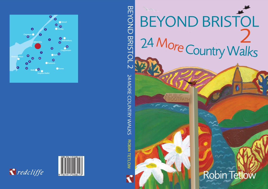
EXTRACT FROM WALK NO.23 (PAGES 132 - 133)
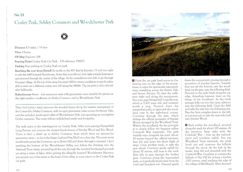
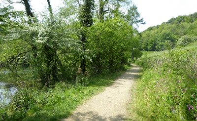
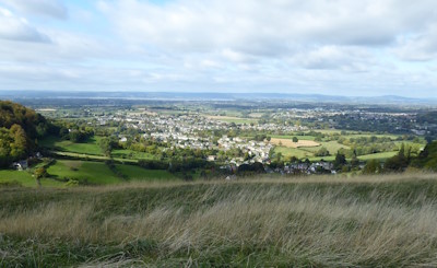
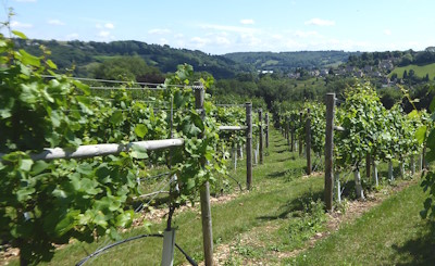
GALLERY FROM WALK NO.23
These photographs were all taken by the author.
Numerous further photographs encompassing all 72 walks across all three books can be viewed on the regularly updated Instagram @beyondbristolwalks account – with over 650 posts and over 1450 followers! Follow the link at the foot of this page.
WALK UPDATES
Before embarking upon any of the walks, it is recommended that you read the introductory sections of the books, which include a wealth of information and practical advice. Whilst most walks should proceed entirely to plan, you need to be prepared for the unexpected! The author regularly checks the routes, mainly to ensure that they remain passable and free from obstruction but also to identify any material changes.
Carrying a pair of secateurs in your rucksack will prove invaluable in clearing overgrown vegetation, particularly by gates and stiles.
Fortunately, the most obvious changes the author has found is the routes of walks becoming more clearly defined than when first devised – by reason of both more frequent use and improved signage! Other changes are likely to be minor and/or temporary. The most common is the simple substitution of gates in place of stiles, which should rarely cause confusion.
Very occasionally, significant changes do arise – some only temporary, others more permanent. Obstructions or damage can be reported to the relevant Highway Authority for their action, which the author has done successfully on several occasions. Minor diversions can result.
The author aims to keep the information on each of the walks as current as possible. Each of the updates listed below remains relevant to the author’s knowledge.
August 2026. Walk 10 – Review of Preferred Option B-C
Following re-check on 06.08.26, including path clearance at several points of the total route. The path up to, the highly recommended, Llanmelin Fort remains easily passable. However, the author’s judgement is that the originally ‘preferred’ route for descent has now become unduly challenging. The initial section along the fort perimeter remains passable, if overgrown. However, the subsequent steep descent beyond the stile has become more difficult, with fallen trees significantly blocking/ obscuring the route of the path. The author’s reluctant recommendation is to avoid this option for now. Instead, after duly exploring the fort, simply descend the way you originally ascended and turn left along the road to reach point C.
October 2026. Walk 13 – Two Very Minor Issues, B-C and D-E
Following re-check on 10.10.26, including moderate path clearance.
B-C – upon entering the ‘extensive field’ at the end of Stilemead Lane, you can now go straight along the field towards the field gate (rather than the convoluted route around the field edge in the original description). D–E – the entrance to the footpath about 75 metres beyond Twinners has been slighly altered. You now take a left-hand alley situated between Old Farm and Longacre Barn. At the end of the alley take the gate to proceed through ‘the garden beyond’, along the right-hand hedgerow.
June 2026. Walk 16 – Minor Route Simplification E-F
Following re-check on 29.06.26. Immediately after crossing the A365, continue uphill on ‘the well-marked footpath’ as instructed. However, recent storm damage has caused a slight reconfiguration of the route of path, thus confusing the subsequent description in the original text. You should now completely ignore the references to a ‘handrailed section’ and a ‘crossing sunken track’. Simply continue steeply uphill on ‘the well-marked footpath’. On reaching the junction of paths, continue straight-ahead alongside ‘the high wall’ on your left. With the gradient of the path now continuing to ease, proceed past the ‘Cotswold stone house’ and ‘the outbuildings of Blue Vein Farm’ as originally directed.
June 2026. Walk 11 – Simple Changes to Route Description F-G and H-I (As partly updated in February 2023 reprint)
Following re-check on 12.06.26, also including some path clearance!
At F, after taking ‘the stile ..by the field gate’, it is now recommended to take the immediate field gate off to the left. Follow the track up the field, pass the ‘large tree’ and continue beyond. Stick with the track through the two further field gates. After the second, turn right and continue through the two further fields up to the A48 (as per the original instructions).
Shortly after H, along ‘the driveway’, upon taking ‘the stile in the fence off to the left’, within the field, ‘the powerline pole’ upon which the original instructions rely has been removed! Upon entering the field, now continue downhill towards the River Severn beside the driveway. At the field corner turn left along the bottom hedgerow and, after about 200 metres, look out for the ‘hidden stile/footbridge/stile’, leading ‘into the adjacent field’.
July 2026. Walk 12 – Minor Route Simplification B-C
Beyond point B, within the ‘next’ field after the first one, the slight mismatch noted between the route shown on the OS map and the route on the ground is no longer relevant. The route on the ground has become fully consolidated, making the complicated elaboration in the original text redundant. The precise route shown on the map (much more evident back in 2019) has now become virtually impassable!
Upon entering the field, simply follow half-right across the field using the well-trodden path. Follow through the wide gateway and continue across the next field in a similar direction, aiming for ‘the corner of the spinney ahead’, as originally described.
October 2026. Walk 2 – Further Update re Very Long Field (Essentially as per February 2023 reprint)
Further report on 04.10.26, reaffirming that the route through the ‘very long field’ between points A and B remains easily passable – abetted by ongoing collaboration with Gloucestershire County Council. As is evident from long experience, the precise route of the path continues to vary considerably throughout the year. Essentially keep all the way along/ down the field until reaching the riverside – where by turning left you can’t be wrong!
January 2025. Walk 3 – Map Correction
Point F is shown slightly incorrectly on the map. It should be located slightly further eastwards, at the road crossing.
October 2026. Walk 18 – Clarification on Route D to E/ Update re ‘Archers in Woods’
Re the alternative route between these points, at the end of the path along the former railway line you reach a road bridge. Continue under the bridge and bend right with the path, to reach the road. Turn right along the road and over the same bridge. Continue until re-joining the main route at E.
During May 2026, within the woodland just after point F, a formal ‘notice’ stating ‘Caution: Archers in Woods’ was reported as fixed to the main gate along the route (immediately adjacent to another sign proclaiming the virtues of the Countryside Code!). Following a formal report to the Highway Authority, the landowner has now completely removed this ‘notice’ (checked 06.10.26). In any event, the author in his long experience of walking this route, has never observed any archery taking place in these woods.
June 2025/ Updated September 2026. Walk 14 – Slight Changes in Goblin Combe
On 25.09.26 author re-checked. The results of the recent forestry works by the Avon Wildlife Trust at the upper end of Goblin Combe, towards E are confirmed. Keep ahead through the gate at the ‘information board’ and continue up the main track all the way to the next (new) gate at E, exactly where the right-hand (waymarked) path you need bears off uphill – in the direction of Wrington.
June 2026. Walk 24 – Routes up Knowle Hill (As partly updated in February 2023 reprint)
On 20.03.25 and again on 15.06.26, the author found the recommended (minor) route up Knowle Hill in section G-H fully overgrown. Do not let this put you off from making the climb! Other lesser routes up this open access land have now appeared instead. To be absolutely certain, follow the main path straight uphill, bear left around the hillside and then take successive right-hand turns – to arrive at the seat at the very top. From the seat, return downhill initially on on this same path and then straight-ahead ‘to the far perimeter hedge’, as originally described.
January 2021/ Updated July 2026. Walk 1 – Diversion. (Amended in March 2021 reprint et seq)
08.01.21 and further updated 13.07.26. Initially necessitated by changes to the footpath network around Park Farm, between points F and G, following report of 02.01.21 and author visit. Park Farm needs to be approached differently than is set out in the initial 2019 imprint. From point F, keep straight-ahead along the Monarch’s Way. Within the meadow, beyond the first gate/footbridge/gate, turn sharp left. Re-check on 13.07.26 revealed that the subsequent loss of field boundary features and waymarking diminishes the revised instructions (in the 2021 and 2023 imprints). On turning left in the meadow beyond the bridge, head for a single post, situated beside a ditch and trough in the (now) threadbare field boundary. Beyond the post, proceed straight up the (equally degraded) long left-hand field boundary of the next field. Continue through a gate and paddock to reach the Park Farm driveway. From here, follow the footpath around the outer edge of the garden, as waymarked. Exit into the field and resume – towards point G.
It is confirmed that the estimated total walk length is 8 miles/13 kilometres – in later imprints this is always correctly shown on p8 under the walk itself; but in a few copies it may be shown incorrectly on p3 in the list of walks.
BUYING THE BOOKS
Through local shops – The first two volumes of Beyond Bristol Walks retail at £15.00 and the third volume at £16.00. All are published by renowned local publishers Redcliffe Press Ltd and are for sale at a wide range of shops in and around Bristol, including:
Inca; Iota; Waterstones – the Galleries, Clifton, Cribbs Causeway, Bath, Chippenham, Trowbridge, Wells, Weston-super-Mare; Storysmith; Taunton Leisure; Bookmarked (Max Minerva’s); Hartmanns – Portishead; Bookhaus; National Trust – Dyrham Park and Tyntesfield; Bristol Museum; Bristol Dockyards (SS Great Britain); MShed; Riverside Garden Centre; Topping and Company – Bath; Ellis Brigham; Gloucester Road Books; Chepstow Books – Chepstow; Books on the Hill – Clevedon; Heron Books; The Book Cellar; The Small City Bookshop; We Make Bristol; Shambles Bookshop; Giggsy’s Barbershop; Sherlock & Pages – Frome; The Cotswold Book Room – Wotton-under-Edge.
Amazon – use the order button above.
Bookshop.org – benefitting a nominated local independent bookshop, including perhaps one of those listed above.
On–line also at: AbeBooks; Alibris; Awesome Books; Blackwell’s; Foyles; Hive; JustBooks; TG Jones; Waterstones; Stanfords.
Direct from the author – available direct from the author (free p&p). Subject to any current special offer – Book 1 = £15.00; Book 2 = £15.00; Book 3 = £16.00. Use the contact form to order – copies can be signed on request.
Redcliffe Press Ltd – http://redcliffepress.co.uk (free p&p).